Education
Sub Category

This lesson walks through 12 climate types of the world. Organized into 9 climates classified by latitude and 3 climate types that can be found at any latitude, Mr. Rueschhoff explains each climate, where they are found, the climate factors that contribute to their creation, and their associated biome.
Climates discussed are Tropical Wet; Tropical Wet/Dry; Humid Subtropical; Humid Continental; Mediterranean; Marine West Coast; Sub-Arctic; Tundra; Icecap; Arid, Semi-Arid; and the Highland Climates.
Together with the previous lesson on the Five Factors of Climates and Biomes, viewers should be able to up their finger on the globe and have a good idea of what it is like there in terms of climate.
While accessible to anyone, this lesson is specifically written to address the educational standards of the Texas Education Knowledge Standards for the World Geography studies course.

The lesson builds upon our look at latitude's impact on seasons and adds four more factors to explain how the Earth's climate is created. In addition to Latitude--the most important factor--are Elevation, Wind Currents, Ocean Currents, and Topography.
The lesson reviews how latitude greatly influences temperature on Earth and introduces how Elevation also has an impact on temperature of regions on Earth. Next, the lesson introduces Wind and Ocean Currents. It explains how convection drives our winds and creates the Hadley Cell and Inter-tropical Convergence Zone (ITCZ) that has a profound impact of climate in the tropics and creates the conditions for some the world's largest deserts.
Influenced by these Wind Currents are the Ocean Currents which are in a constant cycle of warm and cold water exchange between the equator and poles. Why the waters off of the west coast of a continent are usually cool while waters off the east coast are warm are explained. (Hint, it has to do with the Coriolis Effect). The role that El Nino and the North Atlantic Drift have in shaping the climate of the Americas and Europe are discussed as is the impact of Continentality.
The lesson concludes by discussing Topography's role in our climate--chiefly due to the Rainshadow Effect.
While useful to all audiences, this lesson is specifically designed to address elements of the Texas Education Knowledge Standards for the World Geography Studies Course.

This video lesson explains why we have seasons on Earth. Specifically, it examines the Earth-Sun relationship. Viewers will learn it isn't just that the Earth rotates every 24 hours or even that it revolves around the Sun ever 365.25 days. Rather, what is special is that the Earth is titled that means that the Sun's energy (solar insolation) is distributed unevenly on the Earth's surface.
The big takeaway--beyond the fact that the Earth's seasons are caused by the Earth's revolution and tilt--is that latitude is an extremely important factor in determining what makes up the characteristics of a location.
Mr. Rueschhoff uses models to show the stages of this Earth-Sun relationship throughout the year to explain what Solstices and Equinoxes are. He concludes by breaking latitude into three bands (High, Middle, and Low) and explain how these three latitude bands have uniquely different seasons--it's not just Spring, Summer, Fall, and Winter!
A lesson that can be viewed and appreciated by all, but is specifically designed to address standards in the Texas Education Knowledge Standards (TEKS) for the World Geography studies course.

This video lesson looks at external factors that shape the Earth's landforms: weathering, erosion, and deposition. This examination of physical geography and geology aspects of the world includes looking at the differences between chemical and physical (or mechanical) weathering, how rain, wind, ice (glaciers), and even gravity moves sediment, and then how deposition of sediment creates landforms such as river deltas as well as produces fertile areas such as the North European Plain through the deposition of loess.
In addition, a review of what soil is and how it is created is included as well as how these processes create sedimentary rock.
This lesson is designed to not only inform all audiences, but also to focus on the Texas Education Knowledge Standards for the World Geography studies course.

CORRECTION: AT 8:58, I stated that if there is just one Continental Plate you would have Convergent Subduction. I meant to say OCEANIC Plate. Sorry.
Ever heard someone say you're "making a mountain out of a molehill?" Well, I don't actually know what a molehill is (actually, I think I do), but in this lesson, we will examine the Earth's forces that creates its mountains--namely Continental Drift and Plate Tectonics.
This lesson begins by looking at the composition of the Earth and discover that its core, mantle, and crust make it much more like a baseball, than a blue marble that some have called it.
We then look at the outside of the Earth and find that it also has stitches, just like a baseball. Here we learn of Alfred Wegner's examination of the Earth which used records of fossils and rock formations to assert that the continents move--giving rise to the theory of Continental Drift.
While the geology community thought that Wegner was crazy, Harry Hess joined the Navy and through the use of sonar mapped the ocean floor and with carbon dating of the ocean crust, discovered Wegner was right and explained how the continents move through a process not unlike a lava lamp (interested, gotta watch the video--hint, it's through convection of the magma in the asthenosphere).
The lesson then looks at the three major ways that tectonic plates will move in relation to each other: divergence, convergence, and transform boundaries and discover that these moving plates create landforms such as mountains and volcanoes--and even rift valleys.
Because of the different densities, the lesson points out that if there is an oceanic crust involved in a collision of tectonic plates, it will cause something called Convergent Subduction which creates the subduction zone of the Ring of Fire. And if there are two continental plates, it creates Convergent Folding which is the process that continues to create the Himalaya Mountains and Mt. Everest.
All of the movement of these plates, creates a great deal of stress on the crust creates cracks, called faults which is where Earthquakes occur. And the lesson examines how tsunamis are created through underwater earthquakes.
Last, the lesson concludes discussing the Hot Spots that have created the Hawaii Islands as well has turned Yellowstone into a Supervolcano.
This lesson is designed for anyone, but is focused on meeting the Texas Education Knowledge Standards for the World Geography studies course in the State of Texas.

This lesson walks students through the basic landforms on the Earth. This includes plains, mountains, hills, plateaus, peninsulas, islands, archipelagos, valleys, and canyons. The importance of rivers and the deltas and alluvial plains they create are examined.
The lesson also discusses the difference between oceans, seas, gulfs, and bays. The importance of straits are discussed and how they are the mirror opposite of isthmuses. The difference between lakes and reservoirs--despite usually all called lakes--is pointed out.
Beyond discussing the definitions, as fluid as they might be, the lesson discusses the ways that many of these landforms have been created. This includes the weathering, erosion, and deposition of sediment by wind, water, ice (glaciers), and even gravity. The role that plate tectonics in oceanic and continental plate convergence--either convergent subduction or convergent folding--has in creating landforms such as mountains is shown.
While this lesson can be enjoyed by all audiences, it is designed to meet various standards of the Texas Education Knowledge Standards (TEKS) for the World Geography studies course.

This lesson introduces the viewer to the Four Earth Systems: Atmosphere, Lithosphere, Hydrosphere, and Biosphere.
The lesson explains how each system is made up of sub-components and how each system interacts with the other three systems--all supporting life on Earth.
The Carbon Cycle and Water Cycle are described and the Life Cycle is introduced.
This lesson is designed to satisfy elements of the Texas Education Knowledge Standards for the World Geography studies course.

This lesson looks at the way that countries seek to influence each other. In other words, how countries use power.
Calling upon Mr. Rueschhoff's over 23 years of military service his Master's Degree in Military Studies, he describes the Sources of National Power and the Instruments of National Power. These are concepts used by strategic planners in capitals around the globe.
First, the term power is defined and the concept of the Balance of Power is introduced and its role in keeping world peace.
Then, the lesson looks at what makes a nation powerful through the Sources of National Power which are its physical geography, economics, people, national will, and national direction.
But being powerful isn't enough, it is about how you use this power and Mr. Rueschhoff explains that countries use the DIME: Diplomacy, Information, Military, and Economics. These are the Instruments of National Power. Countries will use a blend of these four instruments to avoid war, gain territory, increase trade, resolve conflicts, and form alliances.
The organizations and alliances that are discussed are the United Nations, European Union, NATO, and OPEC.
While useful to all audiences, this lesson is specifically made to address standards of the World Geography studies course in the Texas Education Knowledge Standards (TEKS).

This is part 2 of our Agriculture and Economies lesson. In part 1, we went over the agricultural and industrial revolutions that made our economies possible.
In this lesson, we go over the 4 Economic Activities (Primary, Secondary, Tertiary, and Quaternary) and the types of Natural Resources. Then, we go over the types of economic systems. We meet Adam Smith and Karl Marx and discuss Free Market, Command (Socialism & Communism), and Mixed Economies. We also briefly discuss Mercantilism and we describe traditional economies.
While all audiences can benefit from this lesson, it is specifically written for a World Geography studies course satisfying multiple standards within the Texas Education Knowledge Standards (TEKS).

This is part one of a two-part lesson that outlines how the agricultural and industrial revolution have shaped our world and our economic systems.
This lesson focuses on the Neolithic Revolution when mankind first discovered agriculture, the Enclosure Movement that spurred the 2nd Agricultural Revolution and the Industrial Revolution, and the Green Revolution.
Useful for all audiences, this lesson was specially designed to be used in Texas classrooms and addresses standards found in the World Geography studies and World History TEKS when it discusses the differences between Subsistence and Commercial Agriculture and the effects of the Industrial Revolution.

This video lesson builds on the discussion about developing and developed countries in the Population Geography lesson. In this lesson, Mr. Rueschhoff describes the United Nation's Human Development Index, how it is determined, and how it can be used to describe countries of the world.
Each of the HDI's dimensions is discussed: Long, Healthy Living, Knowledge, and Standard of Living. This includes explaining the difference between Gross National Income, Gross National Product, and Gross Domestic Product.
Mean and Expected Schooling is discussed as are literacy rates when discussing the knowledge dimension of the UN's HDI.
The lesson concludes with Mr. Rueschhoff showing the population pyramids of a developed country, developing country, and a newly industrialized country and how these relate to the UN's HDI categories.
Thumbnail photograph was used under a Creative Commons license from NigerTZai (BY-SA 4.0).
This lesson introduces the basics of population geography including population demography and population pyramids. Push and Pull factors of migration are also examined.
Specifically, birth rate, fertility rate, mortality rate, and infant mortality rates are defined and different types of population pyramids are examined with how they can help show the developmental status of different countries.
This lesson is provided to satisfy selected standards in the Texas Education Knowledge Standards for the World Geography studies course.

This lesson explores culture: defining what culture is, what are its basic elements, and how it shapes our world today.
Concepts such as ethnocentrism, ethnicity, cultural hearths, cultural diffusion, cultural divergence, cultural convergence, acculturation, and enculturation are explained for the viewers. In addition, the role that technology and innovation have in making culture dynamic is discussed.
As culture is not only dynamic, but also symbolic, language as a mirror of culture is examined. Aspects of language are defined such as language families, dialects, and how lingua francas are used in the world.
While applicable to anyone who is wishing to better understand what culture is and what it entails, this lesson is provided to specifically address elements of the Texas Education Knowledge Standards of the World Geography studies course.
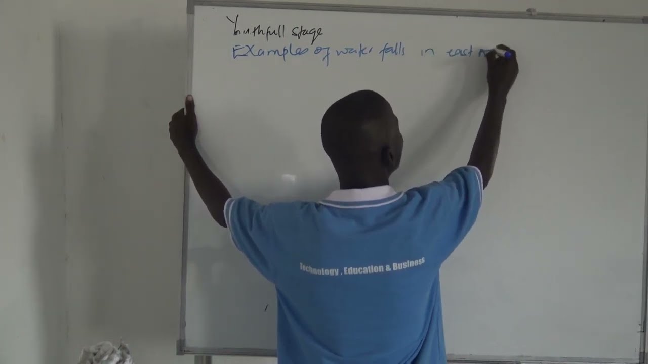
FORM II
MAIN TOPIC : MAP READING
SUB TOPIC : Introduction to map reading
Properties of the earth.structure of the earthSpinning and Rotation of the earthTheories of continental driftF.B Tailor’s theory of continental driftCriticism of F.B Tailor’s theory of continental driftTheory of sea flow spreadingThe Evidence in support of seafloor spreading Alfred Wegner’s theory of continental driftRelevancy/Evidences to support Wegner’s theory
The Earth, Continental Drift, and Earthquakes are interconnected processes and phenomena that occur on our planet. Let's take a closer look at each of them individually.
1. The Earth: The Earth is the third planet from the Sun and is composed of several layers, including the inner core, outer core, mantle, and crust. The Earth's surface is primarily covered by oceans and continents. It has a diverse range of landscapes, climates, and ecosystems, making it a unique and dynamic planet.
2. Continental Drift: Continental drift refers to the movement of Earth's continents over time. The theory of continental drift was first proposed by Alfred Wegener in the early 20th century. It suggests that the continents were once part of a supercontinent called Pangaea, which slowly broke apart and moved to their current positions. The process of continental drift is driven by the movement of tectonic plates beneath the Earth's surface, which leads us to the next point.
3. Tectonic Plates: The Earth's outer layer, known as the lithosphere, is divided into several large and small tectonic plates. These plates float on the semi-fluid asthenosphere beneath them and are constantly moving. The movement of tectonic plates is responsible for various geologic phenomena such as earthquakes, volcanic activity, and the creation of mountain ranges.
4. Earthquakes: Earthquakes occur when there is a sudden release of energy in the Earth's crust, causing the ground to shake. Most earthquakes are a result of the movement of tectonic plates. When the tectonic plates collide, slide past each other, or separate, they generate stress, which accumulates over time. Once the stress exceeds the strength of the rocks, it is released in the form of seismic waves, causing an earthquake. Earthquakes can range from minor tremors to major, destructive events that can result in loss of life and damage to infrastructure.
Understanding the Earth, continental drift, and earthquakes is crucial for studying the dynamic nature of our planet. It helps us understand the distribution of landmasses, the formation of mountain ranges, the occurrence of earthquakes and volcanic activity, and the overall behavior of the Earth's crust.

Theories explaining formation of block mountain or horst
Formation of a block mountain by compression forces
Formation of a block mountain by tension forces
Formation by relative sinking
Fault scarps/ fault escarpments.
Grabens
Fault guided valleys
Tilt block land scape
Crustal warping

Faulting
The Rift Valley
• The Tension force theory by Gregory
• The compression force by Wayland
• Vertical displacement theory by Dixey
Importance of rift valley

Mineral
Rocks
The process responsible for the formation of igneous rocks in East Africa
Plutonic rocks/ Abyssal rocks:
Hypabyssal/intermediate rocks:
Volcanic rocks/extrusive rocks:
Characteristics of Igneous rocks
Importance/uses of igneous rocks
Characteristics of sedimentary rocks
Importance of sedimentary rocks
Characteristics of metamorphic rocks
Importance of metamorphic rocks
Influence of igneous rocks on landform development in East Africa
Influence of Rock structure on the development of drainage patterns in East Africa.
1. Rectilinear or Trellis drainage pattern
2. Parallel drainage pattern
3. Dendritic and radial drainage patterns.
4. Radial drainage pattern
The relationship between rock hardness and types of slope formation in East Africa

Agricultural production in Monsoon Asia
Favorable Factors intensive agricultural production in Monsoon Asia
Problems faced by agricultural production in Monsoon Asia
Steps being taken to solve the problems of agricultural production in Monsoon Asia
Factors responsible for low level of agricultural productivity in tropical Africa

Agricultural communes in china
Characteristics of communes
Factors that lead to development of agricultural communes in China
Contributions of commune farming in China
Collective farming
Main characteristics of collective farming
Positive contributions/Advantages of collective farming
Ujamaa system in Tanzania
Benefits of the Ujamaa system
Shortcomings of Ujamaa system
Small holding farming
Characteristics of small holding farms
Advantages of small scale farming
Disadvantages of small scale farming
Growing of palm oil trees in Nigeria
Benefits of growing palm oil trees in Nigeria
Factors favoring growing of Palm oil trees in Nigeria
Challenges facing palm oil farmers
Measures being taken to increase palm oil production in Nigeria
Cocoa farming in Ghana
Benefits of growing cocoa to Ghana
Factors favoring growing of cocoa in Ghana
Measures being taken to increase cocoa production in Ghana
Characteristic of plantation farming
Plantation farming in Kwazulu-Natal
Plantation farming in Liberia
Extensive wheat farming in Canada and North America
Factors that favors plantation/extensive farming
Challenges of plantation/extensive farming
Positive contributions/Merits of Plantation/extensive farming
Demerits/Negative contributions of Plantation/extensive farming
The reasons for rapid forest destruction tropical rain forests.
Effects of deforestation on the environment.
Measure being taken to combat deforestation
Temperate coniferous forests
Characteristics of Temperate coniferous forests
Factors that have favored development of the temperate coniferous forests
Differences between boreal forests and tropical rain forests.
Contributions of forestry to the economy of a country

Characteristics of tropical rainforest
Factors that favor the growth of tropical rainforest
Factors favoring exploitation of tropical rain forests
Factors that limit exploitation of tropical forests

Tourism definition
Tourism in California, South Africa, Kenya, and Tanzania
Positive and negative contributions of tourism industry
Problems facing tourist industry in developing countries
Problems facing the tourism industry in developed countries
Factors that influence population distribution
Effects/contrbutions of high population
Population problems in developing countries (Uganda)
Possible solutions to the population problems in developing countries

Definitions of population, population census. The importance of population census in the economy. Factors which influence migration of people, Determinants of population growth rate, Population distribution in the world, The population distribution in Africa: nigeria, Egypt, Kenya, China, Canada, India,

UACE 250/2 geography paper 2 topic:advantages of road and railways transport, ,contributions of road and railway transport, problems facing road and railtransport in Africa


watch more about field work , CALCULATING THE ARE AND DISTANCE OF IRREGULAR OBJECTS
remember to subscribe to our channel
https://www.youtube.com/channe....l/UCjQAJ5BfF4jdOMDvc
email us at : info@tebtalks.com
website; tebtalks.com
watch more about field work , GEOGRAPHY PAPER 1, MAP WORK, GRID REFERENCE AND BEARING,
remember to subscribe to our channel
https://www.youtube.com/channe....l/UCjQAJ5BfF4jdOMDvc
email us at : info@tebtalks.com
website; tebtalks.com

watch more about field work , how to use Recording method as one of the ways of collecting data collection during the field study
remember to subscribe to our channel
https://www.youtube.com/channe....l/UCjQAJ5BfF4jdOMDvc
email us at : info@tebtalks.com
website; tebtalks.com

watch more about field work , how to use QUESTIONERE method as one of the ways of collecting data collection during the field study
remember to subscribe to our channel
https://www.youtube.com/channe....l/UCjQAJ5BfF4jdOMDvc
email us at : info@tebtalks.com
website; tebtalks.com
watch more about field work , how to use QUESTIONERE method as one of the ways of collecting data collection during the field study
remember to subscribe to our channel
https://www.youtube.com/channe....l/UCjQAJ5BfF4jdOMDvc
email us at : info@tebtalks.com
website; tebtalks.com

watch more about field work , how to use QUESTIONERE method as one of the ways of collecting data collection during the field study
remember to subscribe to our channel
https://www.youtube.com/channe....l/UCjQAJ5BfF4jdOMDvc
email us at : info@tebtalks.com
website; tebtalks.com

watch more about field work , DRAWING A LINE TRANSECT OR RELIEF SECTION FOR FIELD STUDY
remember to subscribe to our channel
https://www.youtube.com/channe....l/UCjQAJ5BfF4jdOMDvc
email us at : info@tebtalks.com
website; tebtalks.com

In this video we shall take you through the introduction of ugandan geography which is geography paper 3

in this video we brings to you the steps you have to follow as your planing to have a successful field work study
Don't hesitate to subscribe to our channel and email us at
info@tebtalks.com for questions

watch more about field work , see the objectives of conducting field work and some methods that are used
watch more about field work , how to use observation method as one of the ways of collecting data collection during the field study
remember to subscribe to our channel
https://www.youtube.com/channe....l/UCjQAJ5BfF4jdOMDvc
email us at : info@tebtalks.com
website; tebtalks.com

watch more about field work , how to use Interviewing method as one of the ways of collecting data collection during the field study
remember to subscribe to our channel
https://www.youtube.com/channe....l/UCjQAJ5BfF4jdOMDvc
email us at : info@tebtalks.com
website; tebtalks.com

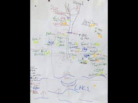
Hello our dear viewers, watch more on physical Geography of East Africa
In this videos you will learn how lakes and rivers where formed in East Africa
